Directorates
The five Chief Directorates of the Department of Environmental Affairs and Development Planning each play a vital role in shaping a sustainable, resilient Western Cape. These include:
Environmental Governance, Policy Coordination and Enforcement,
Environmental Sustainability,
Environmental Quality,
Development Planning, and
Management Support.
Together, they ensure that our natural resources are protected while enabling responsible growth and development. From safeguarding biodiversity and promoting sustainable land use, to guiding spatial planning and ensuring environmental compliance, these Directorates work collectively to balance the needs of people and the environment, laying the foundation for a well-planned and environmentally responsible future. Below is a breakdown of the Directorates and their core functions.

Climate Change Management
The Climate Change Directorate coordinates the provincial response to climate change. Our aim is to integrate response actions into the social and economic developmental service delivery goals of the Western Cape Government.

Biodiversity Management
Biodiversity liaises with and provides oversight to CapeNature on biodiversity policy and strategy matters, promotes biodiversity management, capacity and strategically participate in national, provincial and local biodiversity programmes and projects.

Sustainability
The Directorate: Sustainability’s main vision is the mainstreaming of sustainability in the Western Cape in alignment to the Provincial Strategic Goal 4 (PSG 4), namely, to enable a resilient, sustainable, quality and inclusive living environment.

Coastal Management
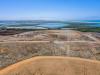
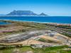
The Department as the lead agency for coastal management in the Province promotes integrated and sustainable coastal and estuarine management, to ensure a balance between socio-economic development and the coastal and marine ecology

Air Quality Management
Air Quality Management provides a supportive and oversight role with respect to air quality management in the Province. The Western Cape has an Air Quality Management Plan (AQMP) which serves an effective tool towards ensuring that the Western Cape reaches its goal of becoming the lowest carbon Province in South Africa
Waste Management
Waste Management is responsible for the facilitation, development and implementation of waste management policies, plans, regulatory measures and systems which support integrated waste management services.

Pollution and Chemicals Management
To develop and implement policy/legislation, strategies and action plans to mitigate and manage water and soil pollution in the Western Cape.

Environmental Law Enforcement
The Directorate has Environmental Management Inspectors (“EMIs”) who enforce environmental legislation in the Western Cape. These EMIs, also known as the “Green Scorpions”, conducts administrative and criminal investigations into serious environmental crimes.

Environmental Governance
Provide co-operative environmental governance in terms of environmental legislation.

Planning and Policy Coordination
The Planning and Policy Coordination Directorate guides integrated environmental and land management planning, develops and aligns policies and legislation, and coordinates key stakeholder engagements at provincial, national, and international levels.

Development Facilitation
Our main aim is to facilitate environmental and planning processes to bring about sustainable development

Development Planning Intelligence Management and Research
The main business of the Directorate is to deliver development planning intelligence services, that assist local municipalities, provincial partners and other stakeholders to better perform their development planning functions.
Development Management Regions 1,2,3
Chapter 5 of NEMA ensures that environmental considerations are integrated into development, mainly through Environmental Impact Assessments (EIAs).

Spatial Planning
The Spatial Planning Directorate is responsible for provincial spatial planning in the Western Cape.

Spatial Information Management
Spatial Information Management takes specific government data and translates it into a tangible visual representation, using Geographic Information Systems technology.