General Fire and Flood Hazard Maps for the Western Cape
(Western Cape Government)
Fire and flood risks in the Western Cape
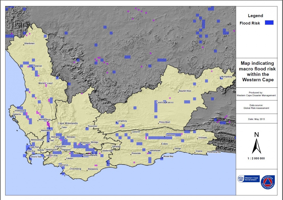
The Western Cape is prone to winter storms and experiences heavy flooding almost every year. The map below shows areas that are most prone to floods during the rainy season, which is generally from June to September each year. The blue areas indicate flood risk areas.
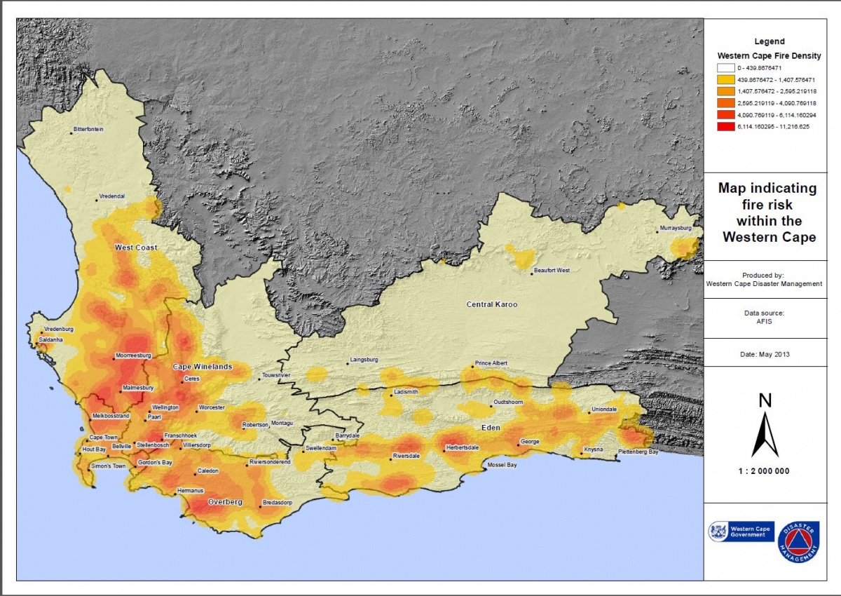
Dry, hot conditions during the summer months increase the risk of veld fires during the province's annual fire season (October to March). The map below shows areas that are most prone to veld fires, with the darker colours indicating a higher risk of fires.
The content on this page was last updated on 12 May 2015
|
We are pleased to share with you that the Western Cape Government (WCG) has once again achieved certification as a Top Employer in 2024. |
||||
 |
Western Cape Government © 2023. All rights reserved.
This project is an initiative of the Western Cape Government. |
 |